Those who are looking for an Uluru map will find there are many options. They can be bought in shops or online, but can also be found for free. Hotels in Yulara and Alice Springs give simple maps out to guests, as do tourist offices in these areas. Those who forget can even pick one up at the Uluru Culture Centre within the national park.
Alternately, tourists with internet access can simply go to Google and pull up a map of Uluru for free. These will zoom right in, displaying road numbers as well as footpaths and points of interest.
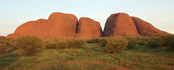
Visitors who plan ahead can print out these maps of Uluru National Park, as well as one of Kata Tjuta (The Olgas), which are about 35kms to the west of Uluru.
Yulara is closer to the rock, at about 20kms to the north, while Alice Springs is off to the northwest, 335kms as the crow flies.
Those who have a scout around online will find some websites with maps of Uluru available in PDF format. These typically include keys with points of interest in the area, so are often more useful than standard Google maps.
The Australian government also provides fairly detailed Uluru maps on its own website.
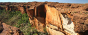
For those taking tours of Uluru National Park, the guides generally supply an Uluru map, including Kata Tjuta and Kings Canyon. The Culture Centre at the southern end of Uluru is the last resort, although in reality a map isn’t always needed as it’s all pretty straightforward once you arrive.